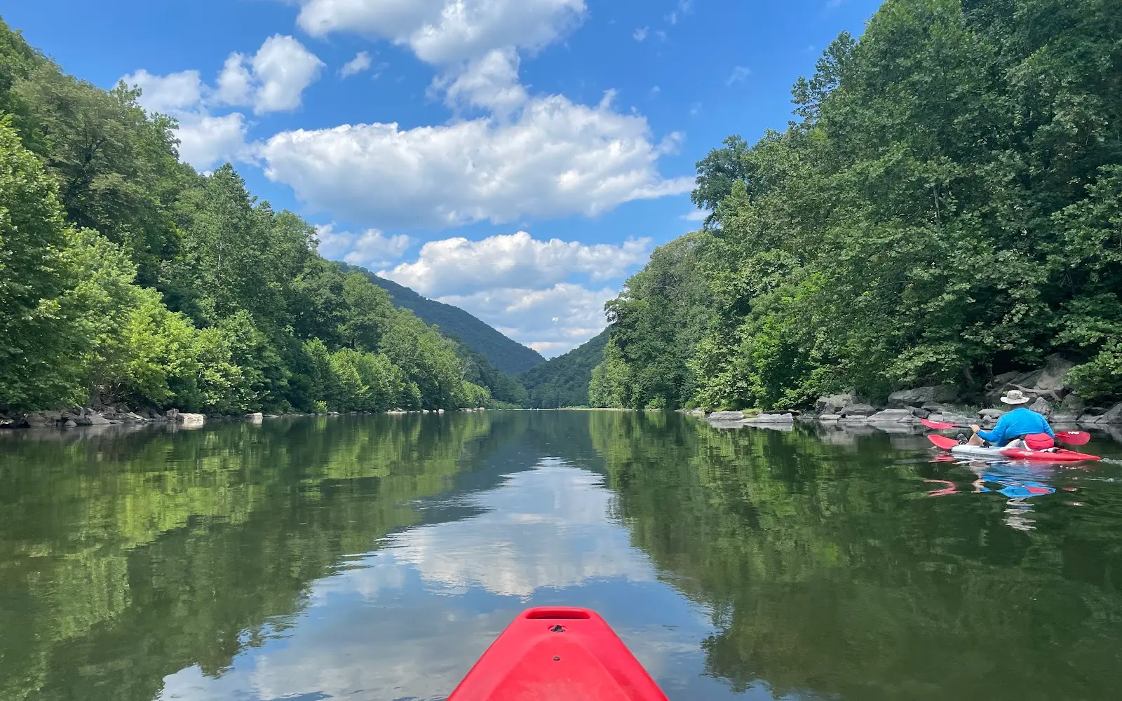
Calleva Trough Outfitters
Calleva Trough Outfitters is a kayak & canoe livery in Romney.
Gallery
Outfitter details
- Disciplines
- Kayaking, Canoeing
Rivers & creeks near this outfitter
Loads the full map of the rivers near this listing. We leave it off by default so the page opens fast on mobile data.
Paddler reviews
What paddlers are saying
- AAbby· 4 years ago
What an awesome ride! We booked online same day, and waited for someone for about 45 minutes, so definitely recommend calling, too, if it’s less than 1 day out (the people before us were late and delayed their schedule). It all worked out great though, Christian was super friendly and accommodating and immediately got us going. This is the longest run we’ve ever done and Wow. It’s a stunner, you won’t be disappointed! The water was low and it was still great (had to walk & drag only once for a tiny bit). Plenty of deep areas so you aren’t scooting around on rocks. It took longer since it was low (7 mi/4 hrs), paddling most of the time - so plan timing with the water level. The scenery is amazing - we saw deer, fish, turtles, huge rock faces, a train go by and over a bridge (with waving riders :) ), the tiniest frogs I’ve ever seen (pulled over for a snack), and we even had tiny ‘rapids’ to make it exciting (no skill needed, we’re amateurs). We texted Christian from the water (there’s a sign 200 yards from the takeout) and he was there in a jiff. Smooth and fun day, thanks Calleva!!
- MMark Avadikian· 4 years ago
Second time using Calleva Trough Outfitters for shuttle service. Great service very friendly driver. We did the shorter run with kayaks stopping along the river about half way (eagle rock). Apparently you can just stop and camp overnite in that area. We just stopped for a shore cooked shrimp and fish lunch with a water view! Potomac Eagle train comes by ocasionally and love it when you give the passengers a wave. Saw many eagles and some balanced stones on the shore! Some shallow spots and a couple of faster rapids. We did it with a 7 year old in his own kayak with no issues. Mostly an easy paddle, will do again!
- RReilly Harbison· 3 years ago
Outfitter was prepared, knowledgeable and extremely helpful. They were also very responsive with communications and aided us with insight as to the best camping spots along the river...spoiler alert: we got what passers-by called "the best spot on the river". They even dropped some dry wood for us along the river because we launched in a downpour. The river was gorgeous, albeit a little slow. But it was a nice canoe trip and quite easy to navigate. Not dicey enough to necessitate a tie down with the gear. Highly recommend.
- TTF Farrow· 6 years ago
Have not been here for years, but always brought my children to canoe here, and with them, when they were young. Though it's a dryer time of year, and waters are not as high, it was a beautiful, and a memorable time. Who cannot love seeing Wild Eagles in their natural environment, or the mountain splendor in its full rainbow of colors. The owners were so friendly, and gave so much information of the river, ( we booked a day before in person, and no matter how many questions I asked, or memories I spoke of, lol" he was still patient with it all.) His wife the next day greeted us and was just as friendly. It is seasonal so soon they will close til spring. I would highly recommend going out, they shuttle you to the drop off spot, ours a close to 7 mile river trip.. which took us a few hours, but it depends on how quickly you travel, we wanted to just absorb it all in a leisurely manner, we had a picnic packed with us, and stopped as we wanted to check areas out that are usually covered by higher waters. Prices for the 2 of us, with shuttle, canoe and life jackets couldn't be beat. Still after all these years I have been here, it's still a great family run establishment.. What a wonderful time, and another new ( minus children as mine are grown now) to have made, I hope to return next spring..and wish the Eagle Trough the best as they close for the season, til next time.. thank you. FYI" this is off the beaten path, but only a 10 minute or less drive to get here from main street going thru Romney.. 5 stars plus some.. well worth the drive to check it out, and remember in season, they book quickly, so dont wait if possible to reserve a time, but call or stop ahead of time to not miss out"
Reviews powered by Google. Content belongs to its respective authors.
Typical flow by month
1994 to 2002
The water at Calleva Trough Outfitters typically runs highest in March, at a median 1,760 cfs, and lowest in October, at 165 cfs. The highest flow on record for any single day is 64,600 cfs, in 1996.
| Month | Typical (cfs) | Usual range (cfs) | Relative level |
|---|---|---|---|
| January | 1,060 | 369 to 2,220 | |
| February | 1,480 | 545 to 3,025 | |
| March | 1,760 | 1,120 to 4,050 | |
| April | 1,045 | 780 to 2,210 | |
| May | 1,120 | 549 to 2,460 | |
| June | 473 | 312 to 1,120 | |
| July | 277 | 211 to 688 | |
| August | 283 | 153 to 775 | |
| September | 172 | 133 to 406 | |
| October | 165 | 130 to 378 | |
| November | 255 | 159 to 871 | |
| December | 629 | 215 to 1,050 |
Typical is the median of each month’s daily median values, and the usual range runs from the median 25th to the median 75th percentile, across about 9 years of record. Statistics published by the US Geological Survey for South Branch Potomac River near Moorefield, WV (site 01608070). Conditions on any given day can fall well outside the usual range. Check the current reading before you go.
Current conditions
High today
62°F
Wind
7 kt
Gusts 15 kt
Rain chance
80%
Week ahead
Forecast from Open-Meteo global models (NOAA & ECMWF).
More outfitters
Also nearby
Other ways to get outside within about an hour of here.
Free tools
Your free outdoor toolkit

Everything Map
Listings, trails, spots, clubs and public land on a single full-screen map. Switch layers on and off, then tap any point for the details.
Open Everything MapRiver Explorer
Explore named rivers from the USGS hydrography dataset. Filter by water type or whitewater class.
Open River ExplorerRoute Planner
Drop stops on a map and watch distance and drive time add up. Export a GPX or share the link.
Open Route PlannerPaddling Clubs
Browse local clubs with meeting info and how to join, or start your own for free.
Open Paddling ClubsLive Conditions
Real-time conditions spot by spot, pulled from public weather feeds, before you commit to the drive.
Open Live ConditionsWebcams
Live camera feeds from popular spots. Eyeball the crowd, the surf, or the snow before you go.
Open Webcams


