Milwaukee Kayak Tours
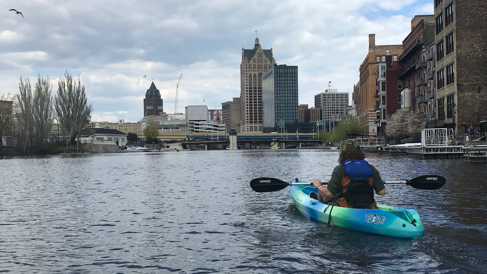
Milwaukee Kayak Tours is a kayak tour operator in Milwaukee. Their tours are suitable for both locals and visitors.
Gallery
Outfitter details
- Disciplines
- Kayaking, Sea Kayaking, Guided Tours
Rivers & creeks near this outfitter
Loads the full map of the rivers near this listing. We leave it off by default so the page opens fast on mobile data.
Paddler reviews
What paddlers are saying
- KKristina Morgan· 2 months ago
Extremely friendly and knowledgeable had some beginners and they had no problems. We had a great paddle.
- JJames Toberman· a year ago
Jenna was an amazing guide! Lots of informative facts about Milwaukee buildings and their history. We had a lovely time!
- JJustin Beaton· 11 months ago
Michael and the crew are the epitome of what you want to find in a local business. They are kind, welcoming, flexible, they have positive/fun attitudes that are infectious to each group, and they really love the city and area! On each kayaking excursion, the guides are attentive, fun to be around, they have great personalities, and most importantly, there is never any pressure of any kind on anyone who might be a first timer. They treat everyone with the care ensuring that all who come out with them have a marvelous time...not to mention, the views are pretty spectacular! I highly, highly, highly recommended heading out to Brew City Kayak for some family time, couples time, or even solo - it will not be the first time you visit, I can promise you that! God Bless, Michael and Co. - thanks so much for the wonderful outing. I was even able to get some sweet GoPro footage on our excursion!
- MMerrielle Buckner· a year ago
We had a really fun time. Our family of three (parents in 40's + teen) went on the 1pm tour. The guide helped us get fitted with life jackets, gave a quick tutorial and assisted us in loading into our kayaks. There were plenty of breaks and it was so fun to be on the Milwaukee River with views on Lake Michigan. It was a totally unique way to tour the city. Our guide was full of fun stories and fun facts about Milwaukee and regional history. She was very thoughtful and aware of safety and paddlers skill level. We took the HOP to get there and walked from the Third Ward stop (one of us walked in crocs). It was totally doable. I would definitely recommend this to other travelers in Milwaukee.
Reviews powered by Google. Content belongs to its respective authors.
Typical flow by month
2009 to 2025
The water at Milwaukee Kayak Tours typically runs highest in March, at a median 208 cfs, and lowest in September, at 46 cfs. The highest flow on record for any single day is 5,210 cfs, in 2010.
| Month | Typical (cfs) | Usual range (cfs) | Relative level |
|---|---|---|---|
| January | 75 | 37 to 146 | |
| February | 95 | 49 to 186 | |
| March | 208 | 113 to 374 | |
| April | 200 | 112 to 403 | |
| May | 157 | 88 to 305 | |
| June | 118 | 49 to 228 | |
| July | 66 | 28 to 178 | |
| August | 47 | 20 to 114 | |
| September | 46 | 16 to 127 | |
| October | 51 | 24 to 130 | |
| November | 57 | 26 to 129 | |
| December | 70 | 40 to 147 |
Typical is the median of each month’s daily median values, and the usual range runs from the median 25th to the median 75th percentile, across about 16 years of record. Statistics published by the US Geological Survey for Menomonee River at 16TH Street at Milwaukee, WI (site 04087142). Conditions on any given day can fall well outside the usual range. Check the current reading before you go.
Current conditions
Streamflow
425 cfs
Above normal (90th)
Water level
13.48 ft
High today
59°F
Wind
15 kt
Gusts 23 kt
Rain chance
10%
Week ahead
Forecast from Open-Meteo global models (NOAA & ECMWF).
More outfitters in Wisconsin
Also nearby
Other ways to get outside within about an hour of here.
Free tools
Your free outdoor toolkit

Everything Map
Listings, trails, spots, clubs and public land on a single full-screen map. Switch layers on and off, then tap any point for the details.
Open Everything MapRiver Explorer
Explore named rivers from the USGS hydrography dataset. Filter by water type or whitewater class.
Open River ExplorerRoute Planner
Drop stops on a map and watch distance and drive time add up. Export a GPX or share the link.
Open Route PlannerPaddling Clubs
Browse local clubs with meeting info and how to join, or start your own for free.
Open Paddling ClubsLive Conditions
Real-time conditions spot by spot, pulled from public weather feeds, before you commit to the drive.
Open Live ConditionsWebcams
Live camera feeds from popular spots. Eyeball the crowd, the surf, or the snow before you go.
Open Webcams


