Wekiwa Springs Adventures
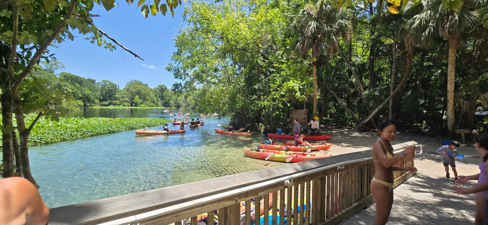
Wekiwa Springs Adventures is a kayak & canoe livery in Apopka.
Gallery
Outfitter details
- Disciplines
- Kayaking, Canoeing
Rivers & creeks near this outfitter
Loads the full map of the rivers near this listing. We leave it off by default so the page opens fast on mobile data.
Paddler reviews
What paddlers are saying
- CChris Webby· 2 months ago
Wekiwa Springs Adventure was such a fun experience! The spring is beautiful, the water is crystal clear, and it’s a great place to cool off, relax, and enjoy Florida outdoors. There’s plenty to do between swimming, kayaking, hiking, and spotting wildlife, so it works great for families or anyone wanting a break from the usual routine. The whole place has a peaceful, natural feel that makes it easy to spend a few hours there without getting bored.
- MMartha Maeda· 3 months ago
Wekiwa Springs is a family favorite. You can swim in the refreshing waters of the beautiful spring, and paddle down the lush Wekiva RIver under the overhanging oaks and cypress trees. The hiking trails in the back of the park offer a chance to glimpse deer and a variety of birds and butterflies. Something for everybody!
- IIsa Criscitello· 9 months ago
Beautiful, peaceful, and absolutely worth the visit! While visiting family nearby, we decided to stop into Wekiwa Springs State Park for a walk on a Tuesday morning in early November. The weather was perfect, sunny and in the high 70s and the park was tranquil, clean, and not overcrowded. Some people were swimming in the natural spring, others were sunbathing, and a few were kayaking through the canals. The walking trails were well kept, and the landscape had that gorgeous tropical swamp feel. I loved it! The park has clean bathrooms, a nice (and not overpriced!) gift shop, and a concession stand with a good variety of snacks. We were so impressed that we returned on Friday. This time, we rented a tandem kayak for two hours for $40 and paddled upstream to the island where there’s a delicious fish fry food truck. Along the way, we spotted three gators sunning on the shore, several turtles, and a great variety of birds. The water plants alone are stunning. Entry is only $6. You do need to make a reservation online, but on slower days they’ll let you in at the gate for the same fee, reservations just help prevent overcrowding. We had such a wonderful experience both times. I highly recommend visiting this beautiful park!
- RRashida· 4 months ago
Beautiful place! We went on a Saturday so it was pretty busy on the water. It was our first time and didn’t realize the line to get in would take so long. Luckily the staff were super helpful and were able to reschedule us for the next slot.
Reviews powered by Google. Content belongs to its respective authors.
Typical flow by month
1972 to 2026
The water at Wekiwa Springs Adventures typically runs highest in August, at a median 47 cfs, and lowest in May, at 10 cfs. The highest flow on record for any single day is 986 cfs, in 2022.
| Month | Typical (cfs) | Usual range (cfs) | Relative level |
|---|---|---|---|
| January | 16 | 8.6 to 26 | |
| February | 17 | 9.0 to 29 | |
| March | 14 | 6.9 to 27 | |
| April | 12 | 5.6 to 24 | |
| May | 10 | 4.2 to 20 | |
| June | 24 | 11 to 43 | |
| July | 38 | 21 to 64 | |
| August | 47 | 23 to 78 | |
| September | 47 | 25 to 87 | |
| October | 30 | 17 to 55 | |
| November | 14 | 10 to 24 | |
| December | 15 | 8.0 to 25 |
Typical is the median of each month’s daily median values, and the usual range runs from the median 25th to the median 75th percentile, across about 51 years of record. Statistics published by the US Geological Survey for Little Wekiva River near Altamonte Springs, FL (site 02234990). Conditions on any given day can fall well outside the usual range. Check the current reading before you go.
Current conditions
Streamflow
41 cfs
Normal (47th)
Water level
23.88 ft
High today
89°F
Wind
10 kt
Gusts 14 kt
Rain chance
36%
Week ahead
Forecast from Open-Meteo global models (NOAA & ECMWF).
More outfitters in Florida
Also nearby
Other ways to get outside within about an hour of here.
Free tools
Your free outdoor toolkit

Everything Map
Listings, trails, spots, clubs and public land on a single full-screen map. Switch layers on and off, then tap any point for the details.
Open Everything MapRiver Explorer
Explore named rivers from the USGS hydrography dataset. Filter by water type or whitewater class.
Open River ExplorerRoute Planner
Drop stops on a map and watch distance and drive time add up. Export a GPX or share the link.
Open Route PlannerPaddling Clubs
Browse local clubs with meeting info and how to join, or start your own for free.
Open Paddling ClubsLive Conditions
Real-time conditions spot by spot, pulled from public weather feeds, before you commit to the drive.
Open Live ConditionsWebcams
Live camera feeds from popular spots. Eyeball the crowd, the surf, or the snow before you go.
Open Webcams


