
Skippa-Rock River Floats
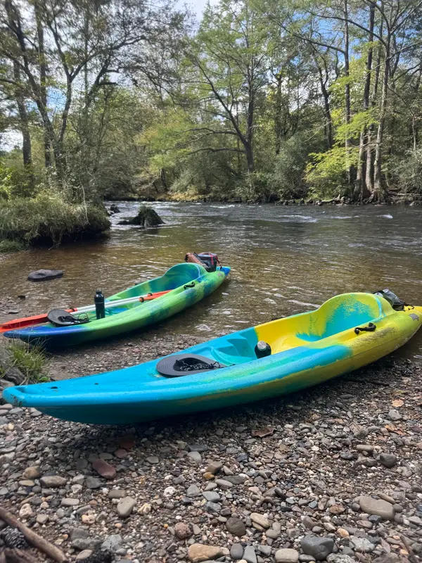
Skippa-Rock River Floats is a kayak & canoe livery in Broken Bow. Trips are suited for guests who want a relaxing day on the water.
Gallery
Outfitter details
- Disciplines
- Kayaking, Canoeing
Rivers & creeks near this outfitter
Loads the full map of the rivers near this listing. We leave it off by default so the page opens fast on mobile data.
Paddler reviews
What paddlers are saying
- BBenjamin Bueche· a month ago
Great place to rent kayaks. If you've never done it before do the 4 mile trip and be prepared to get wet! Just some advice ziplock sacks will not keep your keys or phone dry so bring something to keep your stuff dry and make sure it is securely attached to you. You'll thank me later.
- KKambri Tracey· 2 months ago
We go floating in Broken Bow every year and have used Skippa Rock before. Always a good time! 10 out of 10!
- AAriel Smith· a month ago
Had a blast although signs on the river would be helpful. Advising a 6 year old could do the rapids no problem was a little dumb. The rough rapids were way to rough for most the adults on the 4 mile trip.
- SShannon Smallwood· a month ago
We had so much fun tubing the river! Only regret is I didn’t call them first! No hassle, no reservations! Simple and staff was super friendly and helpful! All we did was show up and pay! And pay less by the way! You will save time and headaches to call them first!
Reviews powered by Google. Content belongs to its respective authors.
Typical flow by month
1970 to 2026
The water at Skippa-Rock River Floats typically runs highest in March, at a median 1,310 cfs, and lowest in October, at 320 cfs. The highest flow on record for any single day is 29,100 cfs, in 2015.
| Month | Typical (cfs) | Usual range (cfs) | Relative level |
|---|---|---|---|
| January | 1,040 | 308 to 2,510 | |
| February | 1,280 | 462 to 2,630 | |
| March | 1,310 | 459 to 3,020 | |
| April | 1,165 | 332 to 2,985 | |
| May | 1,010 | 344 to 3,020 | |
| June | 769 | 331 to 2,075 | |
| July | 722 | 344 to 1,420 | |
| August | 599 | 328 to 1,110 | |
| September | 398 | 235 to 743 | |
| October | 320 | 177 to 620 | |
| November | 372 | 169 to 1,180 | |
| December | 758 | 230 to 2,340 |
Typical is the median of each month’s daily median values, and the usual range runs from the median 25th to the median 75th percentile, across about 56 years of record. Statistics published by the US Geological Survey for Mountain Fork near Eagletown, OK (site 07339000). Conditions on any given day can fall well outside the usual range. Check the current reading before you go.
Current conditions
Streamflow
421 cfs
Normal (49th)
Water level
1.71 ft
Water
78°F
High today
96°F
Wind
10 kt
Gusts 19 kt
Rain chance
4%
Week ahead
Forecast from Open-Meteo global models (NOAA & ECMWF).
More outfitters in Oklahoma


Also nearby
Other ways to get outside within about an hour of here.

Free tools
Your free outdoor toolkit

Everything Map
Listings, trails, spots, clubs and public land on a single full-screen map. Switch layers on and off, then tap any point for the details.
Open Everything MapRiver Explorer
Explore named rivers from the USGS hydrography dataset. Filter by water type or whitewater class.
Open River ExplorerRoute Planner
Drop stops on a map and watch distance and drive time add up. Export a GPX or share the link.
Open Route PlannerPaddling Clubs
Browse local clubs with meeting info and how to join, or start your own for free.
Open Paddling ClubsLive Conditions
Real-time conditions spot by spot, pulled from public weather feeds, before you commit to the drive.
Open Live ConditionsWebcams
Live camera feeds from popular spots. Eyeball the crowd, the surf, or the snow before you go.
Open Webcams


