
Riverside Outfitters
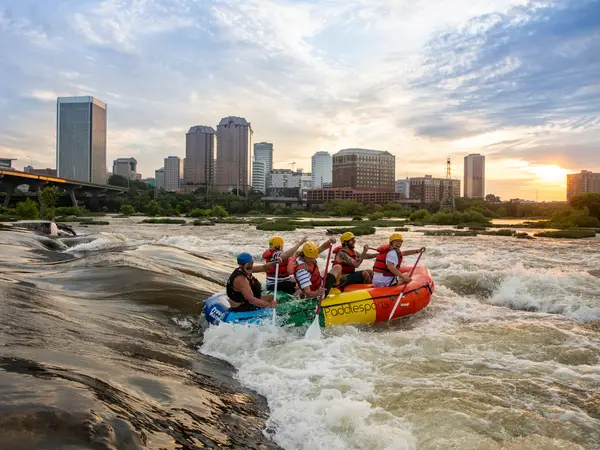
Riverside Outfitters is a whitewater rafting outfitter in Richmond. They offer whitewater rafting, canoe and kayak rentals, and tubing on the James River.
Gallery
Outfitter details
- Disciplines
- Rafting, Whitewater
Rivers & creeks near this outfitter
Loads the full map of the rivers near this listing. We leave it off by default so the page opens fast on mobile data.
Paddler reviews
What paddlers are saying
- MManoj Hari· 3 months ago
We had such a great time rafting with Riverside Outfitters in Richmond, VA! The Level 03 rafting was super fun and exciting — the perfect amount of thrill while still feeling safe and enjoyable for everyone. Big thanks to our guide Noa, who made the whole experience even better. She was friendly, fun, patient, and kept the energy high the entire time. You can really tell she loves what she does. The rock jump was definitely the best part of the trip — such an exciting and unforgettable experience! Overall, one of the highlights of our trip and something we’d highly recommend to anyone visiting Richmond. 🌊🚣
- CChakrapani Gogineni· 2 months ago
Incredible experience! From the moment we arrived, the guides were professional, safety-conscious, and genuinely passionate about what they do. They took time to walk us through every technique before hitting the water, which made even the most intense rapids feel manageable and fun. The guides read the river like pros — anticipating every turn, keeping the energy high, and cracking jokes to keep the whole group loose. Whether it was our first time or we were seasoned rafters, they made sure everyone was included and having a blast. Highly recommend to anyone looking for mini adventures on water.
- LLaura Sarmiento R.· 2 months ago
Hanna and everyone else in the squad were completely amazing, knowledgeable and kind. It was a perfect day with beautiful weather. The river wasn’t too high but the adventure spirit was very much alive!
- MMartin Burkholder· a month ago
Our family of four went whitewater rafting with Riverside Outfitters in late June, and we had a great first‑time experience. Our guides, Dave and Tom, were fantastic—experienced, patient, and fun. We were total beginners, and one of us isn’t a thrill‑seeker, but they made everyone feel comfortable. With the water level around 3.5 ft, the trip was very gentle with only a few rapids, but it was still an awesome introduction to rafting. The kids especially loved jumping off the rock, and the rope swing was the highlight of the day. If you’re looking for a big whitewater adventure, low water levels may leave you wanting more. But for families or anyone wanting a relaxed, safe, and enjoyable introduction to the sport, Riverside Outfitters is perfect.
Reviews powered by Google. Content belongs to its respective authors.
Typical flow by month
1990 to 1995
The water at Riverside Outfitters typically runs highest in March, at a median 36 cfs, and lowest in September, at 1.8 cfs. The highest flow on record for any single day is 1,280 cfs, in 1994.
| Month | Typical (cfs) | Usual range (cfs) | Relative level |
|---|---|---|---|
| January | 23 | 15 to 81 | |
| February | 23 | 8.8 to 97 | |
| March | 36 | 14 to 130 | |
| April | 23 | 14 to 53 | |
| May | 11 | 4.0 to 43 | |
| June | 4.1 | 1.5 to 17 | |
| July | 5.7 | 2.0 to 12 | |
| August | 4.2 | 1.7 to 26 | |
| September | 1.8 | 1.4 to 7.8 | |
| October | 2.6 | 1.7 to 11 | |
| November | 7.4 | 3.3 to 23 | |
| December | 18 | 9.2 to 58 |
Typical is the median of each month’s daily median values, and the usual range runs from the median 25th to the median 75th percentile, across about 5 years of record. Statistics published by the US Geological Survey for Upham Brook near Richmond, VA (site 02042426). Conditions on any given day can fall well outside the usual range. Check the current reading before you go.
Current conditions
Water level
4.30 ft
High today
74°F
Wind
11 kt
Gusts 26 kt
Rain chance
54%
Week ahead
Forecast from Open-Meteo global models (NOAA & ECMWF).
More outfitters in Virginia
Also nearby
Other ways to get outside within about an hour of here.

Free tools
Your free outdoor toolkit

Everything Map
Listings, trails, spots, clubs and public land on a single full-screen map. Switch layers on and off, then tap any point for the details.
Open Everything MapRiver Explorer
Explore named rivers from the USGS hydrography dataset. Filter by water type or whitewater class.
Open River ExplorerRoute Planner
Drop stops on a map and watch distance and drive time add up. Export a GPX or share the link.
Open Route PlannerPaddling Clubs
Browse local clubs with meeting info and how to join, or start your own for free.
Open Paddling ClubsLive Conditions
Real-time conditions spot by spot, pulled from public weather feeds, before you commit to the drive.
Open Live ConditionsWebcams
Live camera feeds from popular spots. Eyeball the crowd, the surf, or the snow before you go.
Open Webcams


