Outdoor Adventure Centers - OAC Tours
About
Gallery
Outfitter details
- Disciplines
- Kayaking, Canoeing
Rivers & creeks near this outfitter
Loads the full map of the rivers near this listing. We leave it off by default so the page opens fast on mobile data.
Paddler reviews
What paddlers are saying
- NNaomi Dove· a month ago
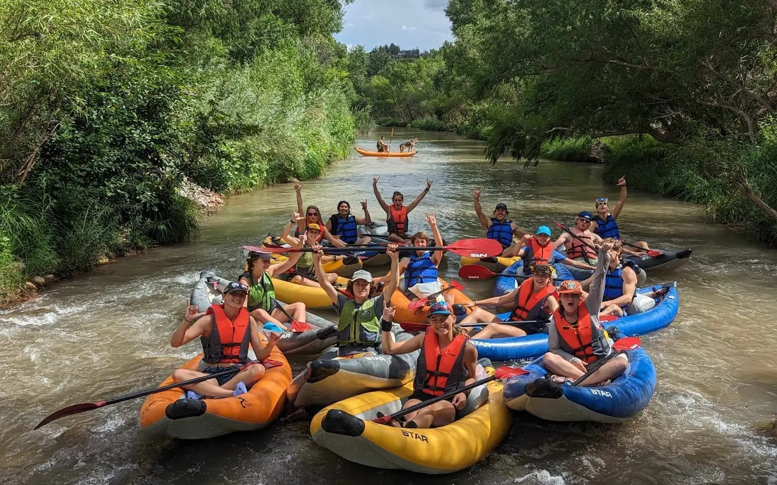
AMAZING EXPERIENCE!! Easy signup, easy check-in and they made needed items available (vests provided, rental shoes available, affordably priced sunglasses, hat, and water available for purchase). Our guides took amazing care of our entire group. They used the drive down to the river to give us a quick tour of Cottonwood. When we arrived at the loading dock, they provided water cannons for all of us to enjoy the river and also made efforts to color coordinate our kayaks so that each group could have their own color and unloaded/ loaded all of the kayaks for everyone. They prepared us for each section with rapids and took pictures for the entire group! Such knowledgeable, friendly, and highly experienced river guides! Highly recommend even if you’ve never kayaked before.. So improessed by OAC tours!!!
- GGrace Masaoka· 5 months ago
Had such an amazing time on this tour! The river was beautiful and peaceful, and the small rapid sections were super fun to go down! Both of our guides were awesome, knowledgeable, and made the overall experience so enjoyable. They also took lots of pictures for us! It was the perfect way to spend my last full day in Sedona before heading back home. Highly recommend this tour if you’re looking for a fun activity :)
- MMaria Lambert· 4 months ago
Fun day with great guides. Nick and Jai were very helpful and knowledgeable. They made sure everyone was safe and helped ensure each guest safely navigated the areas of the river with rapids. The photos they took were wonderful. The Tantrum Wine room was cute. Nice relaxing way to end the day
- NNichole Newbold· a month ago
OAC Tours is a very family friendly and customer oriented business! Everyone is friendly and knowledgeable. My family of 6 (youngest child is 12) had an amazing experience on the guided kayak tour. The guides get into the water at any “tricky” spots to help you if needed, but they also give very clear directions so you feel comfortable in the water. To add a little fun we each got squirters to help keep each other cool. I highly recommend!
Reviews powered by Google. Content belongs to its respective authors.
Typical flow by month
1940 to 2026
The water at Outdoor Adventure Centers - OAC Tours typically runs highest in March, at a median 89 cfs, and lowest in June, at 19 cfs. The highest flow on record for any single day is 14,000 cfs, in 1967.
| Month | Typical (cfs) | Usual range (cfs) | Relative level |
|---|---|---|---|
| January | 40 | 36 to 58 | |
| February | 49 | 37 to 143 | |
| March | 89 | 39 to 278 | |
| April | 36 | 32 to 76 | |
| May | 25 | 22 to 29 | |
| June | 19 | 17 to 22 | |
| July | 20 | 17 to 24 | |
| August | 24 | 20 to 31 | |
| September | 25 | 22 to 30 | |
| October | 28 | 25 to 31 | |
| November | 34 | 32 to 39 | |
| December | 38 | 35 to 45 |
Typical is the median of each month’s daily median values, and the usual range runs from the median 25th to the median 75th percentile, across about 83 years of record. Statistics published by the US Geological Survey for Oak Creek near Cornville, AZ (site 09504500). Conditions on any given day can fall well outside the usual range. Check the current reading before you go.
Current conditions
Streamflow
26 cfs
Normal (58th)
Water level
1.98 ft
High today
91°F
Wind
11 kt
Gusts 17 kt
Rain chance
2%
Week ahead
Forecast from Open-Meteo global models (NOAA & ECMWF).
More outfitters in Arizona
Also nearby
Other ways to get outside within about an hour of here.

Free tools
Your free outdoor toolkit

Everything Map
Listings, trails, spots, clubs and public land on a single full-screen map. Switch layers on and off, then tap any point for the details.
Open Everything MapRiver Explorer
Explore named rivers from the USGS hydrography dataset. Filter by water type or whitewater class.
Open River ExplorerRoute Planner
Drop stops on a map and watch distance and drive time add up. Export a GPX or share the link.
Open Route PlannerPaddling Clubs
Browse local clubs with meeting info and how to join, or start your own for free.
Open Paddling ClubsLive Conditions
Real-time conditions spot by spot, pulled from public weather feeds, before you commit to the drive.
Open Live ConditionsWebcams
Live camera feeds from popular spots. Eyeball the crowd, the surf, or the snow before you go.
Open Webcams


