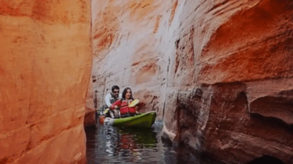
Hidden Canyon Kayak
About
Gallery
Outfitter details
- Disciplines
- Lessons, Kayaking
Rivers & creeks near this outfitter
Loads the full map of the rivers near this listing. We leave it off by default so the page opens fast on mobile data.
Paddler reviews
What paddlers are saying
- HHeidi Obrecht· 10 months ago
Fantastic trip with Jasmine as our guide!!!After being at Zion national Park and Bryce Canyon, this actually was our favorite place. We would highly recommend this activity as it was less populated as upper antelope . I will admit the paddle to lower antelope Canyon was a whole lot easier than the paddle back, but that’s just because there were more activity on the lake that caused waves. If you have a chance to take a swim at the end of your paddle, do it! It’s a chilly swim, but a cool experience.
- NNatascha Lotze· a year ago
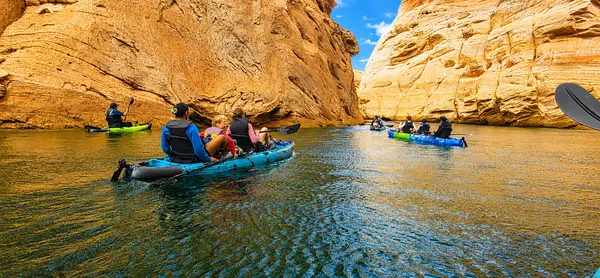
My wife and I had an amazing day kayaking on the calm river with beautiful weather and an incredible walk through the canyon. Our tour guide Noah was so fantastic- he was super knowledgeable, had loads of cool facts and history to tell us about the canyons, the rock formations, the Navajo and the Antelope canyons! Not only did we learn a lot but the experience was super relaxing, Noah really took the time to show us all the cool nooks and crannies of the canyons, all while being professional and making sure everyone was safe. 10000/10
- SSamuel Sokolowski· 2 months ago
We had a great experience with Hidden Canyon Kayak. The staff was very friendly! We were supposed to be back earlier because of a wind advisory and even though we tried we didn't make it back in time so they sent a boat to pick us up. We were very happy with our experience with them!!!
- JJayme Cloninger Nalty· 6 years ago
It’s simple: book Hidden Canyon Kayak. I’ve gone on two different tours with this company (Antelope Canyon in 2018 and Lone Rock in 2020) and they went above and beyond to provide a quality and FUN experience. I think what’s most impressive is there ability to give a quality tour for a diverse group of people with varying levels of experience. In my last group, we had 3 folks who never kayaked before (including 1 person who didn’t know how to swim) and myself and fiancé who love to kayak. We all walked away with a fun tour and great experience. Make sure to ask for Shook, he is one of the best tour guides we’ve ever had. Love these folks. We will definitely book with them again on our next trip to Lake Powell.
Reviews powered by Google. Content belongs to its respective authors.
Typical flow by month
1922 to 2026
The water at Hidden Canyon Kayak typically runs highest in June, at a median 17,200 cfs, and lowest in October, at 8,430 cfs. The highest flow on record for any single day is 124,000 cfs, in 1957.
| Month | Typical (cfs) | Usual range (cfs) | Relative level |
|---|---|---|---|
| January | 10,200 | 5,350 to 13,700 | |
| February | 9,570 | 6,280 to 12,200 | |
| March | 9,770 | 7,660 to 11,800 | |
| April | 11,600 | 9,640 to 17,700 | |
| May | 16,000 | 10,400 to 35,700 | |
| June | 17,200 | 11,900 to 45,800 | |
| July | 15,000 | 11,900 to 20,900 | |
| August | 13,400 | 8,830 to 15,900 | |
| September | 9,770 | 6,330 to 13,300 | |
| October | 8,430 | 6,540 to 10,900 | |
| November | 8,555 | 6,710 to 11,600 | |
| December | 9,320 | 5,770 to 13,200 |
Typical is the median of each month’s daily median values, and the usual range runs from the median 25th to the median 75th percentile, across about 105 years of record. Statistics published by the US Geological Survey for Colorado River at Lees Ferry, AZ (site 09380000). Conditions on any given day can fall well outside the usual range. Check the current reading before you go.
Current conditions
Streamflow
9,100 cfs
Normal (42nd)
Water level
8.42 ft
Water
70°F
High today
86°F
Wind
8 kt
Gusts 17 kt
Rain chance
7%
Week ahead
Forecast from Open-Meteo global models (NOAA & ECMWF).
More outfitters in Arizona
Also nearby
Other ways to get outside within about an hour of here.
Free tools
Your free outdoor toolkit

Everything Map
Listings, trails, spots, clubs and public land on a single full-screen map. Switch layers on and off, then tap any point for the details.
Open Everything MapRiver Explorer
Explore named rivers from the USGS hydrography dataset. Filter by water type or whitewater class.
Open River ExplorerRoute Planner
Drop stops on a map and watch distance and drive time add up. Export a GPX or share the link.
Open Route PlannerPaddling Clubs
Browse local clubs with meeting info and how to join, or start your own for free.
Open Paddling ClubsLive Conditions
Real-time conditions spot by spot, pulled from public weather feeds, before you commit to the drive.
Open Live ConditionsWebcams
Live camera feeds from popular spots. Eyeball the crowd, the surf, or the snow before you go.
Open Webcams


