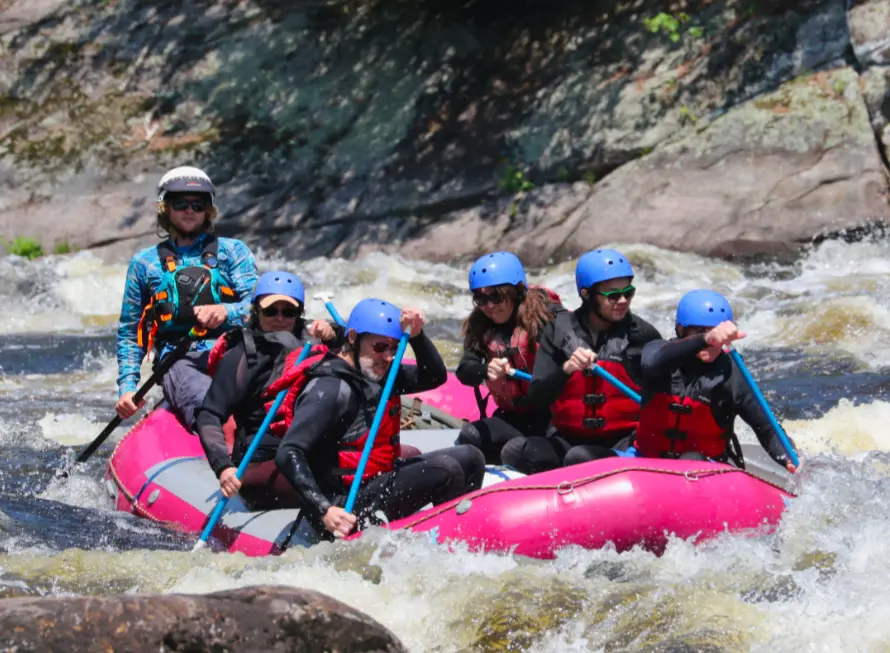
Beaver Brook Outfitters
Beaver Brook Outfitters is a whitewater rafting outfitter in North Creek.
Gallery
Outfitter details
- Disciplines
- Rafting, Whitewater
Rivers & creeks near this outfitter
Loads the full map of the rivers near this listing. We leave it off by default so the page opens fast on mobile data.
Paddler reviews
What paddlers are saying
- TTaylor Madeiros· a month ago
We had an amazing time whitewater rafting with Beaver Brook Outfitters! Cassandra was our guide and she was wonderful throughout the entire trip. Marnie was another guide and brought such great energy, along with plenty of fun jokes that kept everyone laughing. The route had the perfect mix of exciting rapids and more relaxed stretches, including a few great spots to jump in and swim. The scenery was beautiful, lunch was delicious, and the entire experience was well organized from start to finish. I would absolutely recommend Beaver Brook Outfitters to anyone looking for a fun and memorable rafting trip!
- JJason DeVito· a month ago
Loved the guided tubing trip. Our guide Benny made it real fun. It was great getting to know him and about the area. Definitely will be using them for any future adventures! Hopefully others sign the bus roof as well!
- PPaige Agostini· 4 months ago
We had such an awesome experience with Beaver Brook Outfitters!! Our guide was Cass and Benny joined us on the water. Since it's so early in the season, the water was frigid, but Cass made sure to check in with us about how we were feeling, if we wanted more layers, etc. The route was very fun, challenging enough to keep it interesting, but overall very approachable for people of all levels. They were able to accommodate my dietary restrictions for the lunch, and Cass was very informative about the history of the area, the landscape, and what it takes to be a raft guide. We will be returning in the summer!!
- LLori McCaffrey· 2 years ago
Had a great time rafting over Memorial Day weekend. Booking was a breeze and communication about what we needed to bring/wear was great. Our guide, Marnie, was incredible! She was an excellent communicator and adjusted the difficulty level based on what we were comfortable with (yay, surfing!). Lunch was delicious, but I would recommend bringing snacks since it’s a long day and a good workout. Also, don’t forget to put sunscreen on the tops of your hands! We had an amazing time and will definitely be back next spring!
Reviews powered by Google. Content belongs to its respective authors.
Typical flow by month
1907 to 2026
The water at Beaver Brook Outfitters typically runs highest in April, at a median 3,550 cfs, and lowest in September, at 683 cfs. The highest flow on record for any single day is 31,300 cfs, in 2011.
| Month | Typical (cfs) | Usual range (cfs) | Relative level |
|---|---|---|---|
| January | 992 | 700 to 1,400 | |
| February | 900 | 680 to 1,230 | |
| March | 1,200 | 780 to 2,060 | |
| April | 3,550 | 2,255 to 5,610 | |
| May | 2,080 | 1,320 to 3,290 | |
| June | 968 | 648 to 1,485 | |
| July | 689 | 464 to 1,040 | |
| August | 719 | 451 to 977 | |
| September | 683 | 466 to 975 | |
| October | 815 | 590 to 1,320 | |
| November | 1,210 | 827 to 1,890 | |
| December | 1,110 | 769 to 1,700 |
Typical is the median of each month’s daily median values, and the usual range runs from the median 25th to the median 75th percentile, across about 119 years of record. Statistics published by the US Geological Survey for Hudson River at North Creek NY (site 01315500). Conditions on any given day can fall well outside the usual range. Check the current reading before you go.
Current conditions
High today
60°F
Wind
6 kt
Gusts 10 kt
Rain chance
1%
Week ahead
Forecast from Open-Meteo global models (NOAA & ECMWF).
More outfitters in New York


Also nearby
Other ways to get outside within about an hour of here.

Free tools
Your free outdoor toolkit

Everything Map
Listings, trails, spots, clubs and public land on a single full-screen map. Switch layers on and off, then tap any point for the details.
Open Everything MapRiver Explorer
Explore named rivers from the USGS hydrography dataset. Filter by water type or whitewater class.
Open River ExplorerRoute Planner
Drop stops on a map and watch distance and drive time add up. Export a GPX or share the link.
Open Route PlannerPaddling Clubs
Browse local clubs with meeting info and how to join, or start your own for free.
Open Paddling ClubsLive Conditions
Real-time conditions spot by spot, pulled from public weather feeds, before you commit to the drive.
Open Live ConditionsWebcams
Live camera feeds from popular spots. Eyeball the crowd, the surf, or the snow before you go.
Open Webcams


